
The Top of the World Highway is a 127-kilometre (79 mi) long highway, beginning at a junction with the Taylor Highway near Jack Wade, Alaska traveling east to its terminus at the ferry terminal in West Dawson, Yukon, on the western banks of the Yukon River.
The highway has been in existence since at least 1955 and is only open
during the summer months. The entire portion of the highway in Yukon is
also known as Yukon Highway 9. The Alaska portion is short and
apparently not numbered. The Alaska Department of Transportation refers
to it as Top of the World Highway.
As of July 2014, the US portion of the highway is paved, and most of
the Canadian portion is unpaved. The paved Canadian sections are from
kilometer 0 (at Dawson) to 9, 74 to 76, 79 to 82, 83 to 94 and 99 to 104
(at the Canada-US border).
The highway is so named because, along much of its length, it skirts
the crest of the hills, giving looks down on the valleys. It is also one
of the most northerly highways in the world at those latitudes. Two
nearby, farther north highways are the Dempster Highway (Yukon Route 5) and the Dalton Highway (Alaska Route 11). It is not particularly safe in winter, even for snowmobile use, due to the lack of trees for shelter.
A ferry connects West Dawson to Dawson in summer,
and residents living in West Dawson and nearby Sunnydale cross on the
ice during the winter. A bridge is planned by the Yukon government,
although there is significant division among Dawson area residents as to
whether such a bridge should be built. The west-bank residents received
improved phone service only in 2004 but do not have a public
electricity supply.
A 50 kilometre branch road off the highway was used to reach the town of Clinton Creek, Yukon, site of a former asbestos mine shut down since 1979.
The Poker Creek - Little Gold Creek Border Crossing features one of the few jointly-built single building customs ports of entry along the Canada-U.S. border. There is a one-hour difference in standard time zones at this border, which is only open in summer during the 8 a.m. to 8 p.m. period (Alaska time). The immense Alaskan Taylor Complex Fire of 2004 burned up to the Canadian border and was visible from the westernmost portions of the highway.

Crossing The Yukon River on the Ferry From Dawson City

You Do Feel Like You Are On The Top Of The World
People seem to either love this part or hate it.
We think it IS Wilderness Alaska!


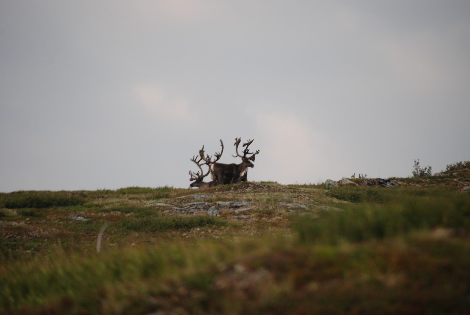
A Large Herd a Caribou!


After Traveling Gravel Roads For Hours You Reach The Border Into Alaska. For The Next 18 Miles Are Some of the Best Roads in All Alaska I call it the "Sara Palin Highway"!! You go from gravel road to this paved section and then back to some of the most challenging gravel roads you'll Travel! It Just Doesn't Fit!!!!

Then it Suddenly Ends With Gravel Again!

Right to Eagle
OR
Left to Chicken!


This Caribou Kept Walking Down The Road In Front of Us.
Turning Back Every So Often To See If We Were Still There.

Looking Down At Chicken, Alaska
Chicken is a census-designated place (CDP) in Southeast Fairbanks Census Area, Alaska, United States.
Chicken is a community founded on gold mining and is one of the few
surviving gold rush towns in Alaska. The population was 7 at the 2010 Census.
Due to mining,
Chicken's population peaks during the summer. It has frequently been
noted on lists of unusual place names.
Chicken was settled by gold miners in the late 1800s and in 1902 the local post office was established requiring a community name. Due to the prevalence of ptarmigan
in the area that name was suggested as the official name for the new
community. However, the spelling could not be agreed on and Chicken was
used to avoid embarrassment. A portion of Chicken, with buildings from the early 1900s and the F.E. Company Dredge No. 4 (Pedro Dredge) are listed on the National Register of Historical Places as the Chicken Historic District.
Chicken is the outpost for the 40 Mile mining district. There are still
active gold mines in this area. Enough gold was mined here to make it
worthwhile to haul huge gold dredges to this remote location.


Nothing Fancy. 15Amp Power, That's It!
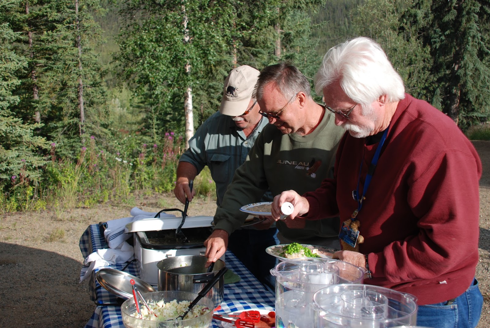
We Had A Great Meal
We Made Homemade Chicken and Biscuits!

With Huckleberry Crisp and Ice Cream Supplied By
Our Hosts!!

Mike and His Staff Helped Us Learn How To Pan For Gold!


Getting Another Shovel Full To Pan!


Our Next Stop Was TOK.
A Chance to Clean Our RVs and Have a Spaghetti With Meatballs Dinner
With More Ice Cream!


Huckleberry Ice Cream!
Back On The Road To Delta Junction!


State Birds!!??!!

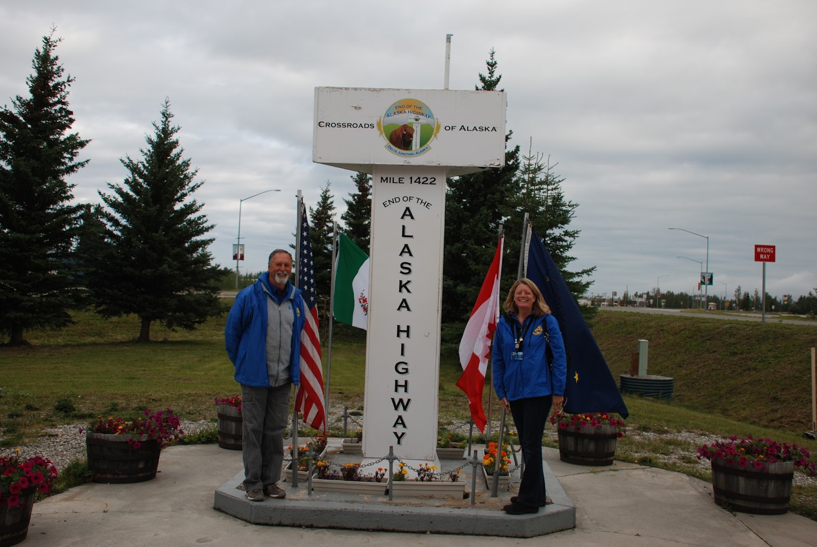
Official End Of The ALCAN Highway!


On To Fairbanks
No comments:
Post a Comment