Kenai Peninsula
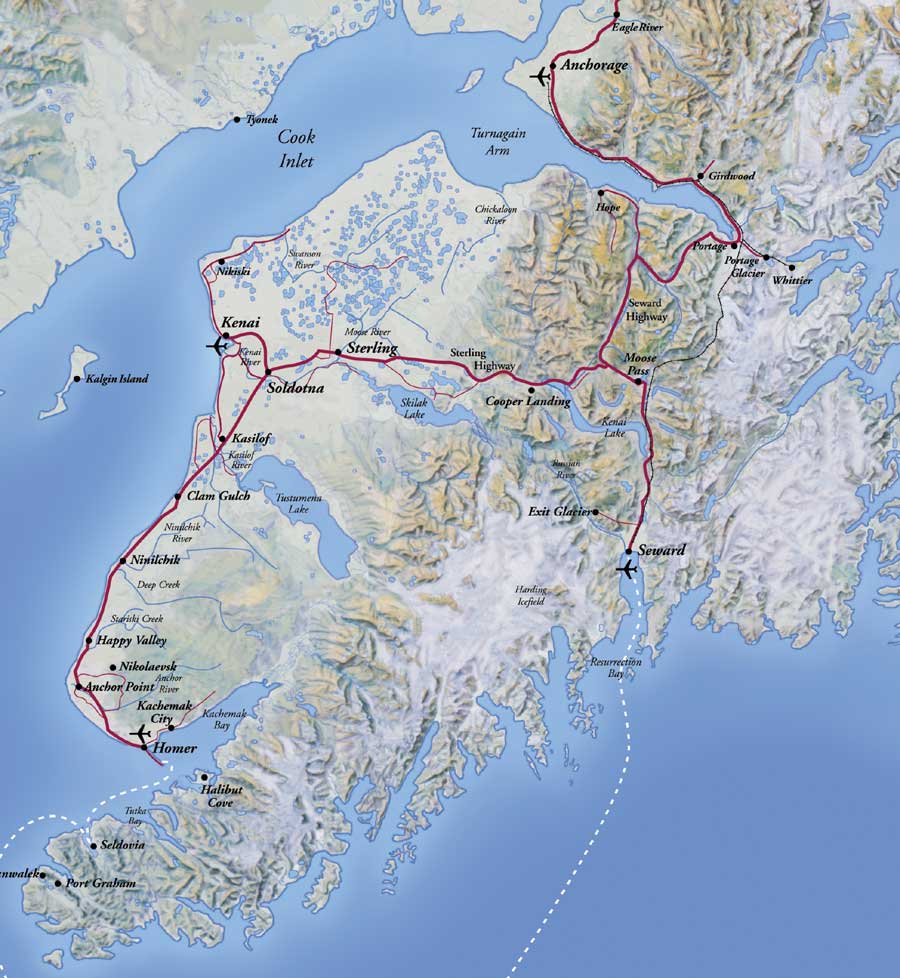
The peninsula extends approximately 150 miles (240 km) southwest from the Chugach Mountains, south of Anchorage. It is separated from the mainland on the west by Cook Inlet and on the east by Prince William Sound. Most of the peninsula is part of the Kenai Peninsula Borough. Gerasim Izmailov was the first European man to explore and map the peninsula in 1789, though Athabaskan and Alutiiq Native groups have lived on the peninsula for thousands of years.
The glacier-covered Kenai Mountains (7,000 ft/2,130 m) run along the southeast spine of the peninsula along the coast of the Gulf of Alaska. Much of the range is within Kenai Fjords National Park. The northwest coast along the Cook Inlet is flatter and marshy, dotted with numerous small lakes. Several larger lakes extend through the interior of the peninsula, including Skilak Lake and Tustumena Lake. Rivers include the Kenai River, famous for its salmon population, as well as the Russian River, the Kasilof River, and the Anchor River. Kachemak Bay, a small inlet off the larger Cook Inlet, extends into the peninsula's southwest end, much of which is part of Kachemak Bay State Park
The Kenai Peninsula has many glaciers in its eastern and southern areas. It is home to both the Sargent Icefield and Harding Icefields and numerous glaciers that spawn off them.
Cities & Towns Of The Kenai
The peninsula includes several of the most populous towns in southern Alaska, including Seward on the Gulf of Alaska Coast, Soldotna, Kenai, and Cooper Landing along the Cook Inlet, and Homer, along Kachemak Bay, along with numerous smaller villages and settlements.
Transportation
Homer famously marks the terminus of the paved highway system of North America and is a popular destination for travelers who have driven to Alaska from the lower 48 states. Seward is the southern terminus of the Alaska Railroad. There are airports with regularly scheduled flights in Kenai and Homer as well as smaller general aviation airports in Soldotna and Seward. The Seward Highway connects Seward to Anchorage, and the Sterling Highway is the backbone of Kenai Peninsula connecting the bigger towns to Anchorage.
Heading To The Kenai From Anchorage

The Turnagain Arm
Turnagain Arm is a waterway into the northwestern part of the Gulf of Alaska. It is one of two narrow branches at the north end of Cook Inlet, the other being Knik Arm. Turnagain is subject to climate extremes and large tide ranges.
Turnagain Arm was named by William Bligh of HMS Bounty fame. Bligh
served as Cook's Sailing Master on his 3rd and final voyage, the aim of
which was discovery of the Northwest Passage. Upon reaching the head of
Cook Inlet, Bligh was of the opinion that both Knik Arm and Turnagain
Arm were the mouths of rivers and not the opening to the Northwest
Passage. Under Cook's orders Bligh organized a party to travel up Knik
Arm, which quickly returned to report Knik Arm indeed led only to a
river.
Afterwards a second party was dispatched up Turnagain Arm and it too
returned to report only a river lay ahead. As a result of this
frustration the second body of water was given the disingenuous name
"Turn Again". Early maps label Turnagain Arm as the "Turnagain River".


Getting Prepared With Site Assignments Before They Arrive - Seward, Alaska

Friendly Neighbor!
EXIT GLACIER

Exit Glacier is a glacier derived from the Harding Icefield in the Kenai Mountains of Alaska and one of Kenai Fjords National Park's
major attractions. It is one of the most accessible valley glaciers in
Alaska and is a visible indicator of glacial recession due to
anthropogenic climate change.
Exit Glacier retreated approximately 187 feet from 2013 to 2014 and
park scientists continue to monitor and record the glacier's
accelerating recession.[1]
It received its name because it served as the exit for the first recorded crossing of the Harding Icefield in 1968.

We Had A Ranger Led Tour!


Those Who Walked All The Way Up The Trail!

Interesting Clouds - Look Closely At The Lines!
We Then - Did A Ride!


Ididaride With The Seavey's
Dallas Seavey, born March 4, 1987 is an American dog musher who is a
three time winner and current record holder in the 1,000-mile Iditarod
Trail Sled Dog Race across the state of Alaska.
At age 25, Seavey became the youngest musher ever to win the race with a time of 9 days, 4 hours, 29 minutes, 26 seconds. In 2014, he again won the race in a record time of 8 days, 13 hours, 4 minutes and 19 seconds. And in 2015 he went on to win his 3rd Iditarod with a time of 8 days, 18 hours, and 13 minutes. By defending his title, he became the 7th person in race history to have won 3 or more times. He also won the Yukon Quest on his first attempt, making him one of only 6 people to ever hold a title in both races. He is the son of 2004 and 2013 Iditarod champion Mitch Seavey. His grandfather, Dan Seavey, is also a veteran Iditarod musher, having competed in the first two Iditarod sled dog races in 1973 and 1974, in addition to the 1997 and 2012 races.
In 2013, Dallas joined 7 other adventurers as the cast of the new hit show Ultimate Survival Alaska on the National Geographic Channel, matching survival skills and wilderness wits over 3,000 miles of Alaska’s toughest terrain.

This Is What Most People Think Of As An Alaskan Sled Dog - BUT
You'd Be Wrong!!
Above Is The Seaveys Pet.
Below Is One Of Many Of Their Competition Sled Dogs!

These Dogs Love To Pull!!

We Got To Hold 12 Day Old Puppies
A WOW Moment!


Carbon Fiber Sled
He Demonstrated Putting Boots On!
The Dog Never Moved


Off To Homer!

Homer is a city located in Kenai Peninsula Borough in the U.S. state of Alaska. According to the 2010 Census, the population is 5,003. Long known as The "Halibut
Fishing Capital of the World." Homer is also nicknamed "the end of the
road," and more recently, "the cosmic hamlet by the sea."
Homer is on the shore of Kachemak Bay on the southwest side of the Kenai Peninsula. Its distinguishing feature is the Homer Spit, a narrow 4.5 mi (7.2 km)) long gravel bar that extends into the bay, on which is located the Homer Harbor.
Much of the coastline as well as the Homer Spit sank dramatically during the Good Friday earthquake in March 1964. After the earthquake, very little vegetation was able to survive on the Homer Spit.
According to the United States Census Bureau, the town has a total area of 22.4 square miles (58 km2), of which 10.6 square miles (27 km2) is land and 11.9 square miles (31 km2) is water. The total area is 52.83% water.

Homer Spit!

We All Had A Great View From Our Camping Sites!


Then We Headed To Palmer!

What Views!


Fireweed Is Almost Gone Now!


Hard To Keep Your Eyes On The Road!

Passing By Anchorage Again


Palmer Campground!


"OPEN GRILL NIGHT"!


Everyone Brought What They Wanted to Grill
As Well As Any Other Dish They May Have Chosen To Share!


A Local Cabbage in The Garden!
Off To Valdez
This Was One Of The Most Scenic Drives!


WOW!!!


The Worthington Glacier is a 5,774-acre (2,337 ha) valley glacier located adjacent to Thompson Pass in the southeastern mainland section of the U.S. state of Alaska. Located on the Richardson Highway at milepost 28.7 mi (46 km) east of Valdez, it was listed as a National Natural Landmark in 1968. The Worthington Glacier State Recreation Site, a 113-acre (0.46 km2)
roadside park operated by the state of Alaska, offers a view of the
glacier, and it is acclaimed as one of the remaining U.S. glaciers that
is accessible by paved highway.
Like most of Alaska’s glaciers, this glacier has been steadily
retreating for the last 150 years, but not as dramatically as many
others.

Valdez


Never Saw Anything Like This Before!


Down in The Valdez Harbor - These Boats Were In!

Three Boats From "The Deadliest Catch"


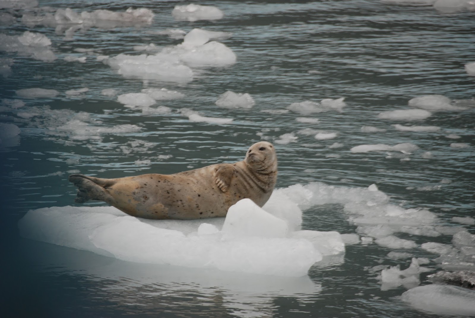
A Boat Tour Of Prince William Sound!


Lots Of Ice Bergs


Sea Otters
The Meares Glacier is a large and only tidewater glacier at the head of Unakwik Inlet in Chugach National Forest, Alaska. The glacier is one of the many in Prince William Sound, and is about 79.6 miles (128 km) east of Anchorage. The glacier is named for eighteenth century British naval captain John Meares. The face of the glacier is one mile (1.6 km) wide where it calves into the inlet. The glacier is sometimes visited by cruises from Valdez. Meares Glacier is currently advancing.


Lots Of Seals


Piece Of The Meares Glacier Ice!


Whales


Sea Lions

Not Bad
1/2 Day Salmon Fishing!

Albert Thought So Too!


Destruction Bay!
Destruction Bay is a small community on the Alaska Highway (historical mile 1083) in Canada's Yukon on Kluane Lake. The population in 2001, according to the Census, was 43. The population was 55 at the 2006 census. Most recently, the population of Destruction Bay in 2011 has dropped to 35 people.
Populated mostly by non-aboriginal residents, community residents provide Yukon government services to residents in the area (school, highway maintenance), including nearby Burwash Landing and some tourism-related businesses along the Alaska Highway. The name is derived from the wind blowing down structures erected by the military during highway construction in 1942–43.
The community has a one-room school serving kindergarten through grade eight.


Leaving Destruction Bay!


Back To Whitehorse!
And
A Visit To The Follies!


The Northern Lights Were Incredible!


SS Klondike was the name of two sternwheelers, the second now a national historic site located in Whitehorse, Yukon, Canada. Both ran freight between Whitehorse and Dawson City along the Yukon River from 1921-1936 and 1937-1950, respectively.
Klondike I was built in 1921 and had the distinction of having
50% more capacity than a regular sternwheeler, while still having the
shallow draft and meeting the size requirements in order to travel down the Yukon River. Klondike I had a cargo capacity of 270 metric tonnes without having to push a barge.
Klondike I ran aground in June 1936 in 'The Thirty Mile' section of the Yukon River (at 61.6713°N 134.8728°W). The British-Yukon Navigation Company (a subsidiary of the White Pass and Yukon Route railway company) salvaged much of the ship and cannibalized the wreckage to build Klondike II the following year.
Klondike II carried freight until 1950. Due to the
construction of a highway connecting Dawson City and Whitehorse, many
sternwheelers were decommissioned. In an attempt to save Klondike II, she was converted into a cruise ship. The venture shut down in 1955 due to lack of interest, and Klondike II was beached in the Whitehorse shipyards.
The ship was donated to Parks Canada
and was gradually restored until 1966, when city authorities agreed to
move the ship to its present location, then part of a squatter's
residence. The task required three bulldozers, eight tons of Palmolive soap, a crew of twelve men, and three weeks to complete. Greased log rollers eased the process.
On 24 June 1967, Klondike II was designated a National Historic Site of Canada, and she is now open during the summer as a tourist attraction.

This Was One Of The Best Preserved Museums We've Seen!

Jade City
Jade City is a "spot on the road" in northwestern British Columbia, Canada, near the Yukon, located on Highway 37, west of Good Hope Lake and close to Cassiar, in the Cassiar Highlands. The region around Jade City is rich with serpentinite (a jade precursor), greenstone (jade look-a-likes),and jade. The region contains one of the world's richest deposits of nephrite jade. The settlement was founded in the mid-80's by jade miner Steve Simonovic. Jade City is by road about 24 hours north of Vancouver, and 1 hour south of the Yukon border. As of 2015, it has a population of about 30 people.
Jade City is a very small town. There are two local seasonally-operated businesses offer highway services and sell jade
products made from nearby formations of the stone. Currently, only one
of the two stores is active. During the summer a church opens up to the
public offering Sunday services.
The reality TV series Jade Fever
documents the mining efforts of the Cassiar Mountain Jade Store, the
Bunce family, and their Chinese backers in the region around Jade City. They mine hard rock deposits and placer deposits left by glaciers. The Bunce family have mined the area for jade for about 40 years, starting with Claudia Bunce's father, Steve Simonovic.
The road from Jade City to our next campground in Dease Lake was closed all day and night due to an accident. Claudia allowed our 24 RV's to stay there and she and her staffed put on the most wonderful turkey dinner for us. What a tremendous lady!!!!!!!
The road from Jade City to our next campground in Dease Lake was closed all day and night due to an accident. Claudia allowed our 24 RV's to stay there and she and her staffed put on the most wonderful turkey dinner for us. What a tremendous lady!!!!!!!


The Next Morning - Snow on The Mountain Tops!


Winter was arriving and telling us time to leave!

This was a large Black Bear!

Salmon Glacier
The Salmon Glacier is a glacier located ~25 km (16 mi) north of Stewart, British Columbia, and Hyder, Alaska, just on the Canadian side of the border. The glacier, one of hundreds in the Boundary Ranges, is notable for its major potential as a natural hazard. Summit Lake
is located at the northern end of the glacier and every year around
mid-July the lake breaks an ice-dam and then flows under the Salmon
Glacier into the Salmon River. This causes the river to rise approximately 4–5 ft (1.2–1.5 m) for several days.


When You Think You've Seen All The Glaciers
Wait!

The glacier splits and runs both North and South!

This Is One Of The Best To Experience!


Old Tunnel Used To Travel Under The Mountain!


Another WOW Day!


Someone Found Bear Poo!

Our Campground Hosts At Stewart Judged Our Chili Cook Off!


First Place!


Scruffy Beard Participants!

Not Sure Who Had More Fun
Judges Or Participants!
You Decide!!!


Joan With The Winner!

The Person Who Spotted The Most Number Of Bears On The Tour Winner!
With One Of Three Bears Made By Joyce!

Second and Third Place Winners!

Special Bear Award!! Congratulations Joyce!

All Our Bear Winners!
Our Farewell Dinner
Always A Sad Time To Say
"GOODBYE"


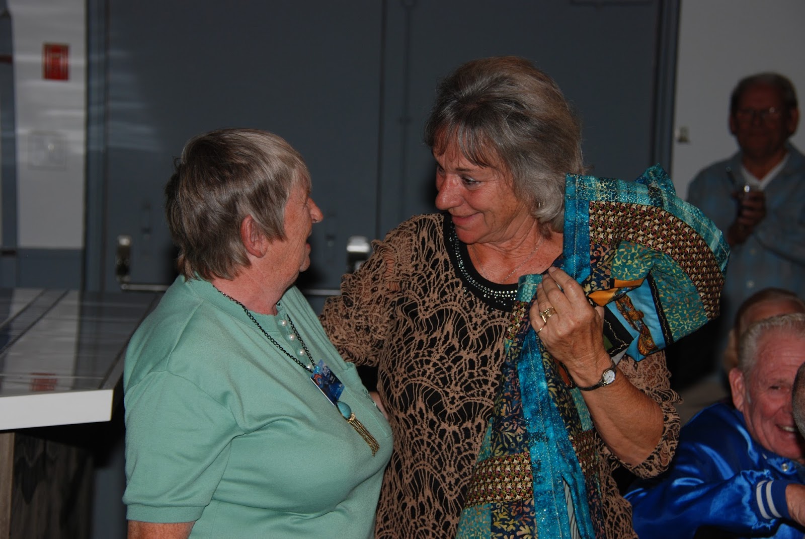
This was a handmade quilt made from fabric samples gathered on our tour by Joyce. We had a drawing to select the lucky recipient.

The Winner!


Heading East Across Canada Back To New York


A Beautiful Elk!


UNTIL OUR NEXT ADVENTURE!!!!
Our 2016 Schedule Is:
South Africa February 22** See Note Below
Kentucky Derby May 02
Made In America Music Tour May 12
Atlantic Provinces Deluxe June 22## See Note Below
Autumn In New England September 16
Best of Branson Holiday Super Rally October 31
Best of Branson Holiday Super Rally October 31
**We Will Be Wagonmastering This Tour Through 2019
## We will be Wagonmastering This Tour in 2017 (June 21)
## We will be Wagonmastering This Tour in 2017 (June 21)
We Hope To See You On One Of Our Next Adventures!!
Give Us A Call And We Can Arrange It for You!!!